
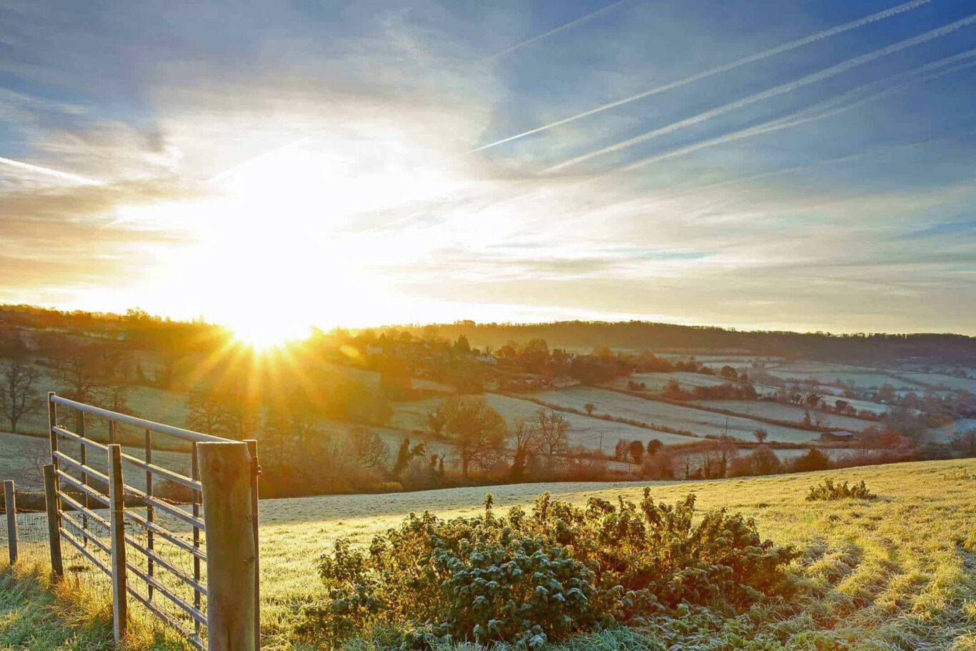
takes around 3 hours Deserted Village
PLEASE NOTE: The plank crossing, at station No. 2, is no longer present and crossing the deep ditch is problematical. This effective barring of the route has been reported to the relevant authority.
A longer walk which takes you south-east of our village through pastural land, around arable fields, through some woodlands and on some minor roads. A couple of major roads need to be crossed and one where walking on the verge for 400 yds is required. Pass the mediaeval village of Fulbrook, once the site of the Duke of Bedford’s castle, built in 1400 but a ruin by 1478! NB. this walk has the potential to be halved in length.
Below is a map and step by step instructions, with photos, but there are also 3 other ways that you can choose to get the information:
- You can download a handy two page guide for this route, which you can print out, by clicking HERE
- This route is published on OutdoorActive, which is a free of charge app for smart phones and can be accessed HERE
- If you have a Garmin, or similar handheld SatNav, you can download the ROUTE.GPX file HERE
Overview Map
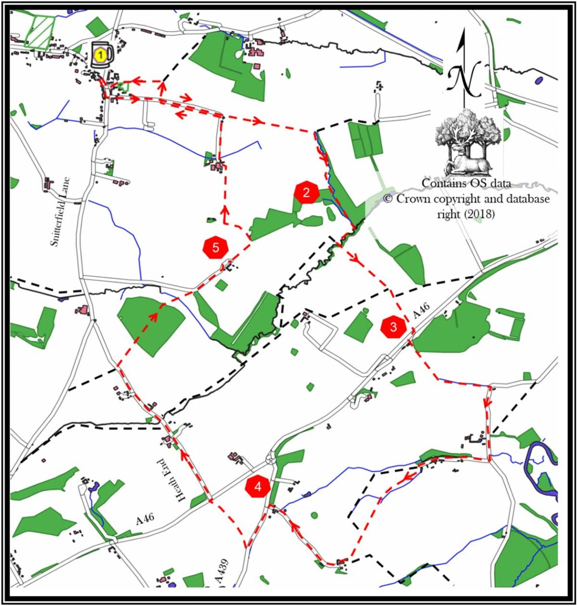
1. Leave The New Inn car park using the pedestrian path. Turn left on to Snitterfield Lane. Continue down the road and after 120m turn left into Canada Lane. Stay on Canada Lane until it bends sharply to the right, at this point leave the road and continue straight on, down the green lane. The green lane stops at a field gate. Go through the gate and continue straight on keeping the field boundary on your left. At the far end of the field turn right within the field; again keeping the field boundary on your left.
2. In the far corner of the field you exit into a young wood via a kissing gate. The path through the wood is not too obvious, so keep parallel to the brook/ditch on your left. The wood closes in on you from your right side. At the ‘end’ of the wood there is a kissing gate into a field. Go through the gate and skirt the field keeping the brook to your left. Continue to skirt around the edge of the field. In the far left corner exit via a wooden style and then a concrete bridge over the brook. Keeping the field boundary on your right cross the next field. Exit the field through a gap in the far end hedge and a wooden bridge. Continue on the same line until you meet the A46.
3. Cross the A46 using the space between the central reservation barriers. This will let you cross the far lane at the point where the footpath continues. Take the track and keep the house fence on your right to a field, again traverse it with the boundary on your right. After 200m you will come to a ditch, cross the next field(s) with the ditch on your left until you reach a minor road. Turn right and continue on this road for about 500m.
Turn right into a tarmac driveway marked “Private Drive Castle Farm…”. Continue for about 500m and the drive goes into a field. On entering the field, keep the boundary on your left and follow it around for about 500m, ignoring the first exit. The boundary turns almost a right angle, adjacent to two oak trees. In this corner are a bridge and a kissing gate, cross these into a field. Continue on the same line to the far side of the field and pass through a metal gate into another field. Keeping this field’s boundary to your right, go up the hill. At the top exit towards a house. Enter its garden through the five barred gate and, keeping the open barn to your right, exit onto a gravel path through a walkers’ gate. Follow the shingle drive through the yard. The shingles turn into a concrete drive which then swings to the right, up a slope and away from the houses.
4. When this drive meets the A439 turn left. Keep on the road verge and cross over when safe. After 400m, just before the yellow-backed chevron road sign, turn right into the field and follow the path across it. This takes you to the A46, cross when safe and turn right then immediately left down Heath End. Walk 1.2km as the road descends then ascends. Just after the road starts to descend again take the bridle path entrance on the right. Follow the fenced path and then continue into the wood. Keeping the ditch to your right, go straight through the wood. Exit via a bridle gate into a field. Diagonally cross this field using a wooden bridge in the middle. Go through a bridle gate and emerge onto a metalled track. Turn right onto it. Its surface changes to stones after a cattle grid. Follow this driveway around the houses.
5. As the drive curves to the right, around the far end of the row of houses, take the grass track on the left into a field. Cross the field and at the far end follow the field boundary as it swings to the left and goes uphill. Exit the field via a wooden bridge and gate on your right. In the next field keep the boundary to your left and go the length of the field; up and down. In the corner is a bridle gate. Exit onto a farm track and turn left and then right, skirting around the low open shed and away from the house. Exit the farmyard via its driveway and continue up the metalled road. Keep on the road as it swings to the left and starts to climb.
After 300m, take the third field entrance on the right (this is the entrance next to the one humorously labelled “Caution Land Mines”). Keep the field boundary to you right and skirt the field’s edge around its corner and up towards the church. Enter the churchyard through a kissing gate. Cross the churchyard keeping the church on your right. Exit through the church gate onto Church Road. Go the length of the road and turn right onto Snitterfield Road. Return to The New Inn for a drink.
If you spot any errors on this page, or would like to make suggestions to make it clearer, please let our webmaster know: webmaster@thenewinn.pub