
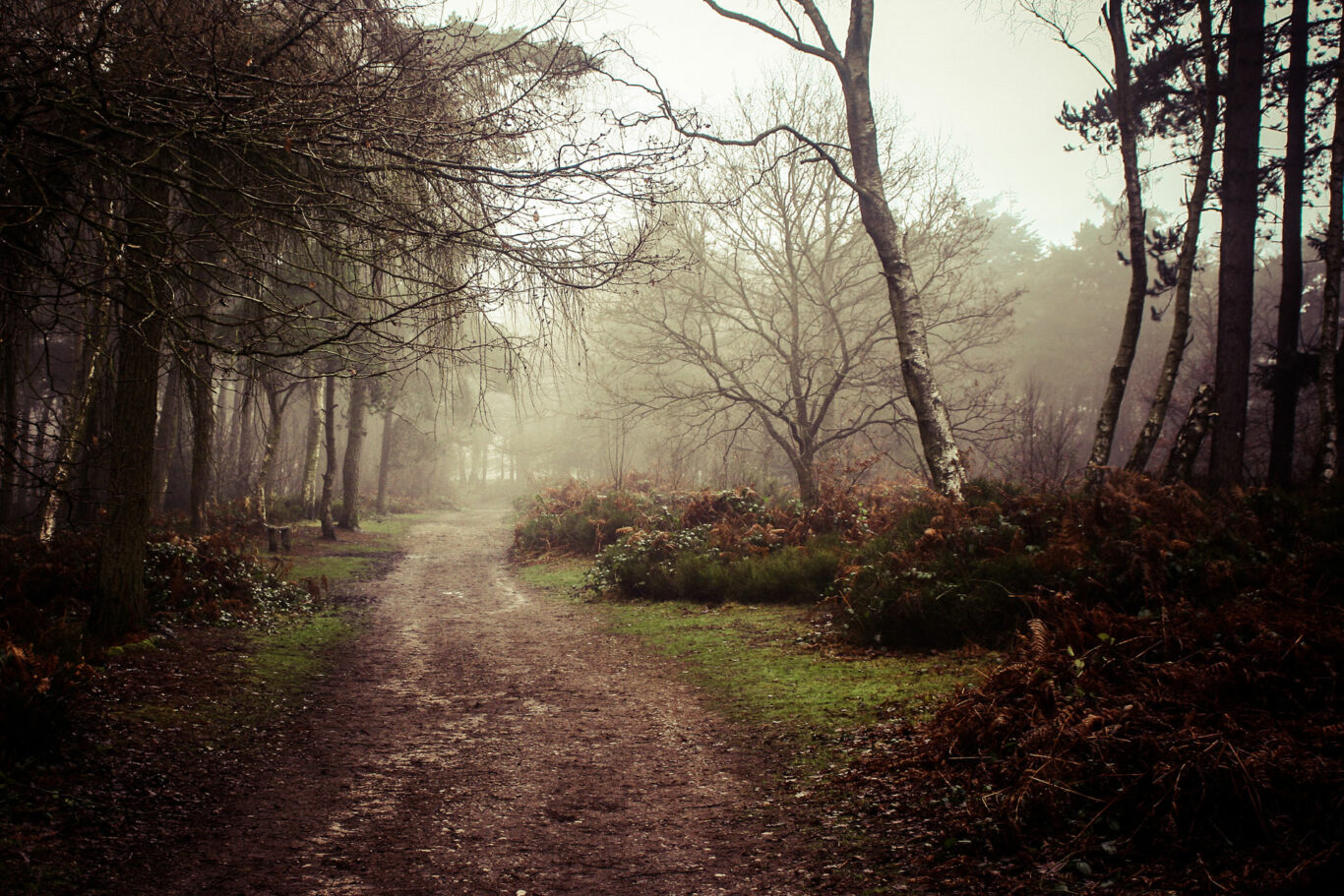
takes around 3 hours Bargain Wood
A shortened version of our Four Parishes walk, this takes you through the gently rolling Warwickshire countryside as it touches two of our neighbouring villages, Wolverton and Claverdon. The walk crosses pastural land and skirts arable fields as well as making occasional use of minor roads.
Below is a map and step by step instructions, with photos, but there are also 3 other ways that you can choose to get the information:
- You can download a handy two page guide for this route, which you can print out, by clicking HERE
- This route is published on OutdoorActive, which is a free of charge app for smart phones and can be accessed HERE
- If you have a Garmin, or similar handheld SatNav, you can download the ROUTE.GPX file HERE
Overview Map
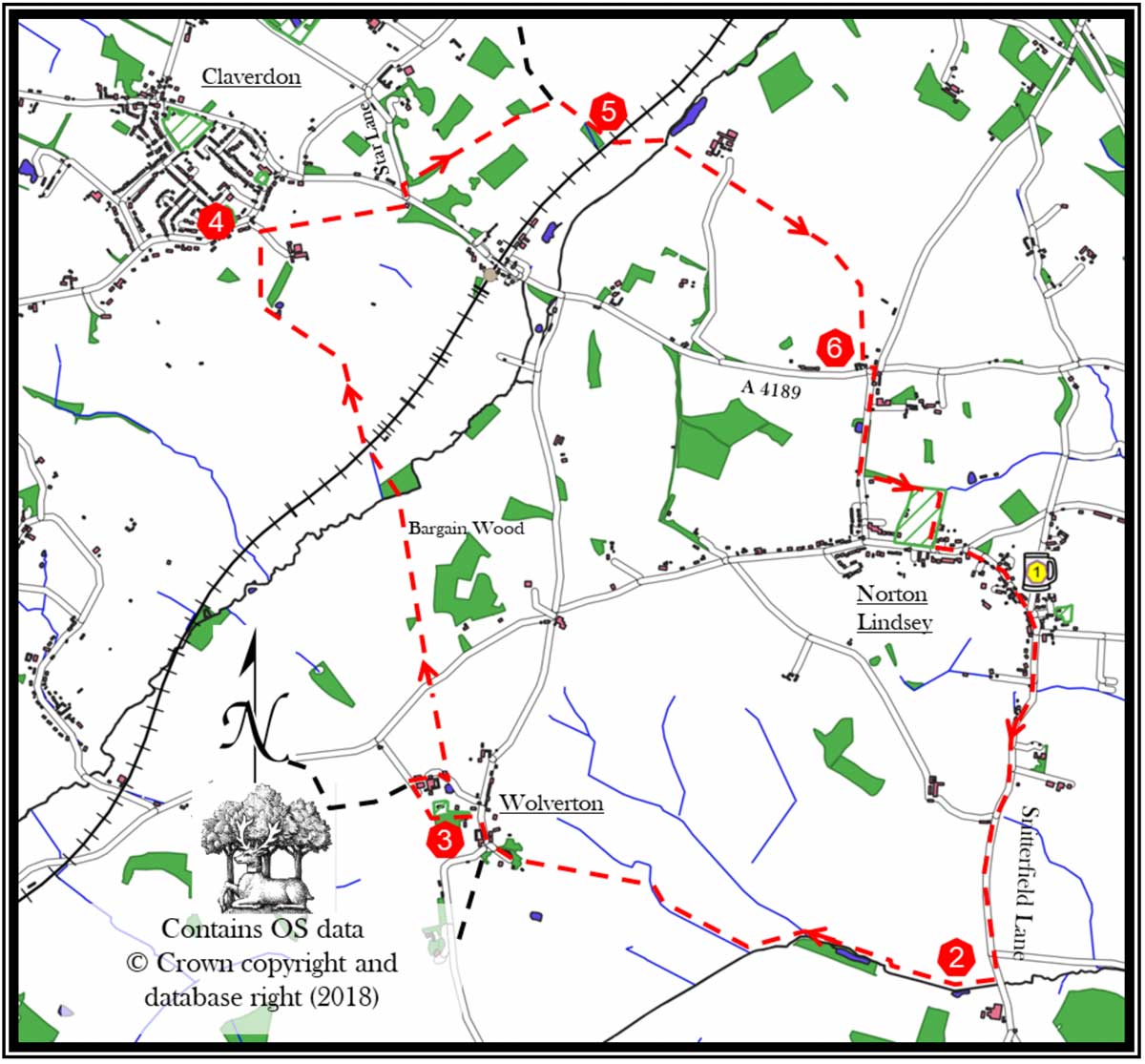
- Leave The New Inn and walk down Snitterfield Lane for approx. one mile to the stream/culvert.
- Cross the (broken) stile on the right-hand side of the road and walk up the field keeping the stream on your left. At far end of this field, pass through the hedge by the telegraph pole, and continue, keeping field boundary on your left. Just after a gate on the left, cross the wooden footbridge on the left, and continue in next field, keeping stream and field boundary on your left. In the field’s diagonal corner is a waymarker sign on your left, cross the stream by the bridge. Keep walking in same direction, with the new field boundary on your right. At the top of the field, follow a muddy track towards the houses in Wolverton, and reach the road.
- Turn right along the pavement. Before the post box, at The Old Rectory on the left, take footpath up towards Wolverton Church. Just past the church, go through the kissing gate, and bear right to the gate in corner of the field. Turn right onto the farm track. Take the second entrance to the farm on the right, and follow the track, keeping left, between the farm buildings, until you come to the bungalow. Immediately before the bungalow, turn right and go through the gate, bearing left down the field. Go through the gate at the bottom, cross the track and go through the kissing gate into a field overlooking Wolverton houses. Just to the left, go through another kissing gate and cross the field to the gate ahead. Go directly across the field through another gate to a road. Cross the road and go through the gate directly opposite. Go to the bottom of the field, keeping the boundary on your right. Go through the gate, views towards Claverdon. Walk down the field, through the gate with the yellow marker, straight across field to a footbridge over a stream. Follow the path through the spinney and emerge turning right into a field. Keep field boundary on your left, cross the railway. In the next field, keep boundary on your left. Head towards Claverdon Church and into the next field.
- When you reach a track bear right then left, following the waymarker through a gate. Diagonally cross the field to top. Go through the gate and turn downhill using the gate on the other side of the track. Head towards a gate with a waymarker. Enter and cross the field, keeping the boundary on your left. Bear left into a wooded area. At the road, go left a short distance, cross the road into Star Lane. Immediately on your right cross the stile into a field. Keeping the field boundary on your left descend over three fields then cross the middle of last descending field. As you enter the first ascending field turn right and follow the field boundary on your right. Go through two fields and two gates heading towards the opening under a railway line.
- Go through a kissing gate, and bear left, heading towards buildings, keeping an old field boundary on your left. Go over a stream, through a gate and head up towards the house. Go through a gate and walk in front of the house. Continuing in the same direction, walk across the driveway. Keep the fence to your left, to a stile in the left-hand corner. Keep the stream on your left in the next field, and just before the field’s crest turn left through a gate. Turn right, keeping boundary on your right, through a gate to next kissing gate. Go through the gate and follow path, emerging into a small field. Go straight on to house driveway and road.
- Cross the road bearing slightly left and proceed down Curlieu Lane. Just past the 30mph sign, enter the spinney on the left. On emerging into the playing field, follow the field boundary clockwise, and exit the field at the opposite corner. Turn left on the pavement. When you reach the Victorian signpost, take the right fork along Main Street. Retire to The New Inn for a well-earned refreshment.
If you spot any errors on this page, or would like to make suggestions to make it clearer, please let our webmaster know: webmaster@thenewinn.pub