
takes around 2.5 hours Wilderness Cottage
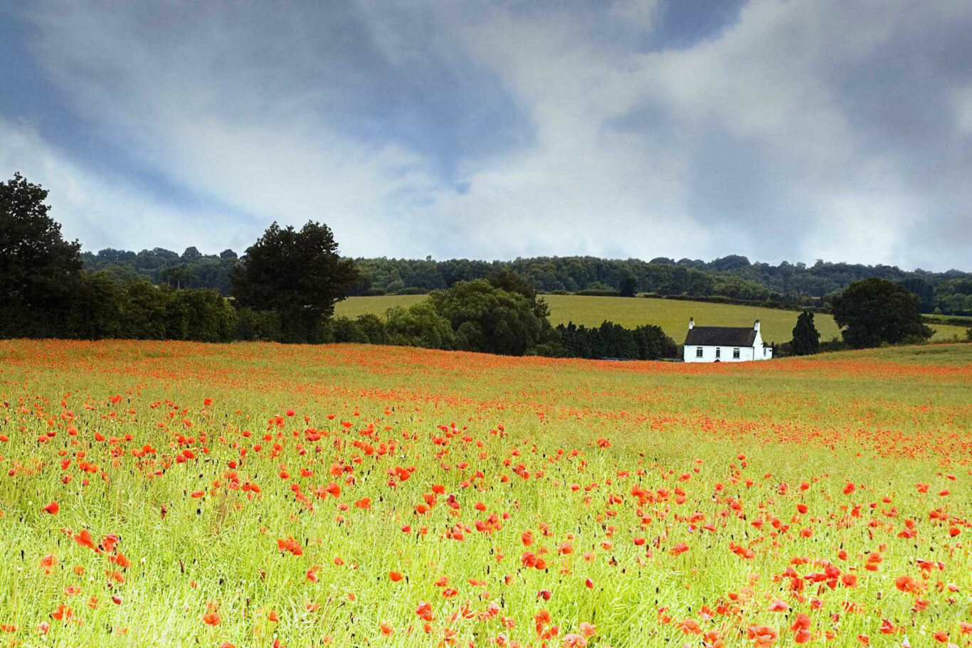
A mid-length walk to the north of Norton Lindsey, which is predominately over open pasture land and country lanes. The route will take you to Wilderness Cottage and then onto Pinley where you skirt round the site of Pinley Abbey. This was a Cistercian nunnery that was founded in the early 12th century and dissolved in 1536. The site of the priory is now occupied by the lands and buildings of Pinley Abbey Farm, and only traces now survive of the original priory buildings.
Below is a map and step by step instructions, with photos, but there are also 3 other ways that you can choose to get the information:
- You can download a handy two page guide for this route, which you can print out, by clicking HERE
- This route is published on OutdoorActive, which is a free of charge app for smart phones and can be accessed HERE
- If you have a Garmin, or similar handheld SatNav, you can download the ROUTE.GPX file HERE
Overview Map
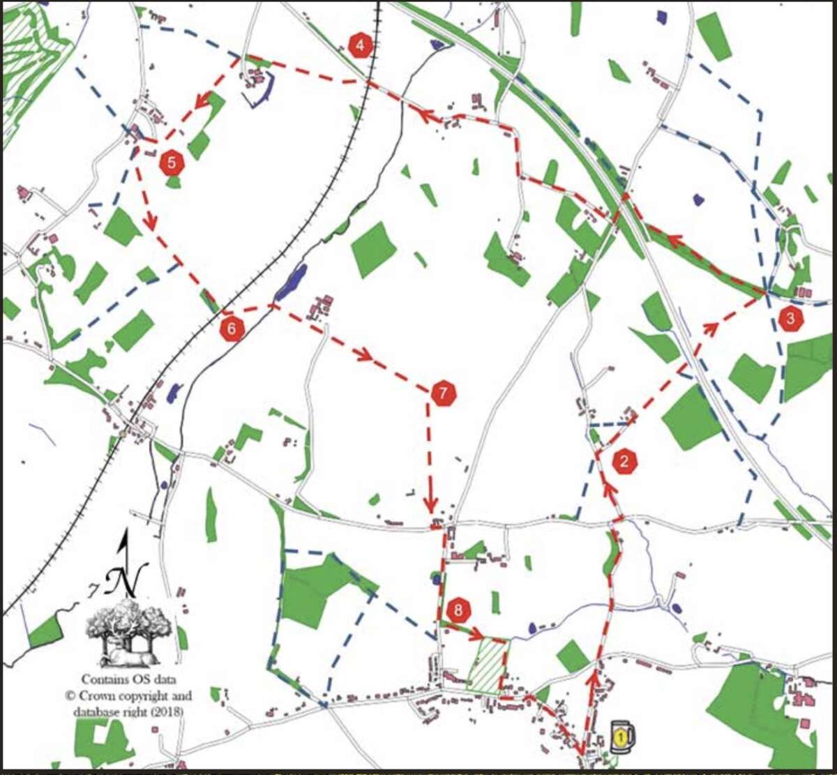
1. Leave The New Inn car park by the vehicle entrance and turn left down New Road. On reaching the crossroads at the bottom, cross over into Brittons Lane. Continue along Brittons Lane until you reach the A4189. Go slightly right then left into Norton Curlieu Lane.
2. Continue for about 300m until you reach the first track, on the right, labelled Horsley. Follow this track and, just past the second house on your left, there is a corrugated barn on the right. Follow the permissive path, keeping the barn to your right. Cross over the motorway and continue, bearing half left across the field to a wide opening in the tree line at the bottom of the field. Go through the opening and, continuing in the same direction, walk up the sloping field to a stile in the field boundary, 100m right of the gate. Turn left, following the field boundary until you reach Wilderness Cottage.
3. At the cattle grid take the wooden, left-most, of the two walkers’ gates onto a footpath, which runs just inside the edge of a long narrow spinney. On reaching an open field follow the left boundary through a pedestrian gate onto a concrete track and turn right. At the end of the track, turn left onto a road (Dark Lane) and after crossing the motorway, take the first right turn (Station Road) signposted Pinley. Follow this road, after 450m it turns sharp right and then sharp left. Then go straight on for another 700m.
4. Immediately after passing under a railway bridge, turn left into a narrow field using a stile. Follow the field boundary on your left, which turns right, then maintain this new heading across the entire field to a walker’s gate in the far boundary fence. Go through the gate, and continue on the same heading, keeping a line of mature trees to your left.
5. On reaching a drive at the end of the trees, turn half left to pass through a gate and cross the drive to a stile on a raised bank. Cross the stile and proceed without changing direction along the left field boundary (through a walker’s gate at one point) across open land by a farm complex, through a kissing gate and across a very small field to an exit gate through a tall conifer hedge. Continue on across the drive to a stile, which leads to a track flanked by tall trees along the boundary of a neighbouring property. The track now follows the boundaries of this property, turning left a couple of times and right, to emerge into a very large open field. Turn half-left downhill to a field gate in the far boundary near the lower right corner. Pass through the gate and continue along the left boundary of the next field until reaching a field gate. Pass through this gate and turn right, following the right boundary of the new field. Continue in this same direction through a gate, a second field, a second gate and under a railway bridge.
6. In the next field, veer half left to pick up a ditch and old hedge line in the middle of the field and follow this, keeping the hedge line on the left. Exit the field, using the vehicle bridge, into the next field. Follow the right boundary to a field gate and then continue, veering slightly right to cross a driveway that passes through the field, and thereafter pick up a fence line, keeping this to your left. Exit the field using a stile at the corner formed by the wooden fence and the hedge boundary, and follow the left boundary of the next field to a walker’s gate about 250m up the field.
7. Passing through the walker’s gate, turn right and continue in the same direction along the right-hand boundaries of two fields, through a kissing gate, across rough ground, a small field/lawn and a gravel drive to emerge onto a main road (A4189). Cross the main road, turn left and then take the minor road directly on your right (Curlieu Lane) signposted Norton Lindsey. Follow this road until 50m past a pond on your right.
8. Take the walking track off to the left through a spinney. Continue through the spinney and emerge at the corner of the sports field. Follow the boundary clockwise around the sports field to the diagonally opposite corner. Exit onto the tarmac footpath and turn left. Go along the footpath until it ends at a point where a Victorian Jubilee signpost (a listed building) sits at the junction of the road. Cross the road into Main Street, where you will see three other listed buildings: The White House (16th century, white timber-framed house) on your right, Barn Cottage (17th century, opposite White House) on your left and Tudor Cottages (17th century, opposite The New Inn) on your right.
Retire to The New Inn for some well-earned refreshments.
If you spot any errors on this page, or would like to make suggestions to make it clearer, please let our webmaster know: webmaster@thenewinn.pub