
takes around 2 hours Canada Meadow
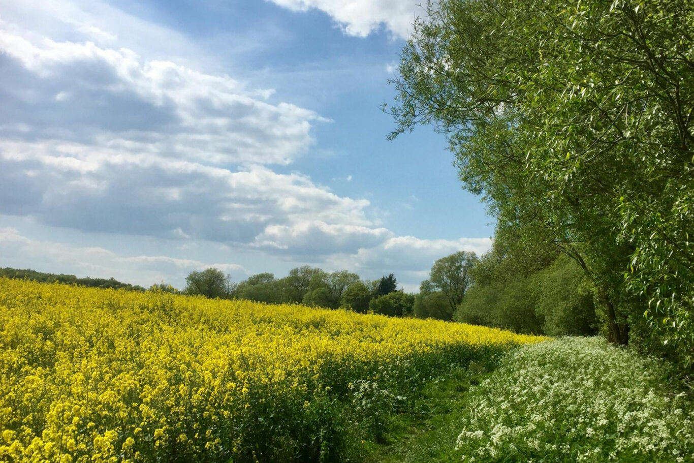
Mid-length walk that takes you south of the village through pastural land, around arable fields, and into some lovely woods. All this is set against the backdrop of our beautiful, gently rolling, Warwickshire countryside.
Below is a map and step by step instructions, with photos, but there are also 3 other ways that you can choose to get the information:
- You can download a handy two page guide for this route, which you can print out, by clicking HERE
- This route is published on OutdoorActive, which is a free of charge app for smart phones and can be accessed HERE
- If you have a Garmin, or similar handheld SatNav, you can download the ROUTE.GPX file HERE
Overview Map
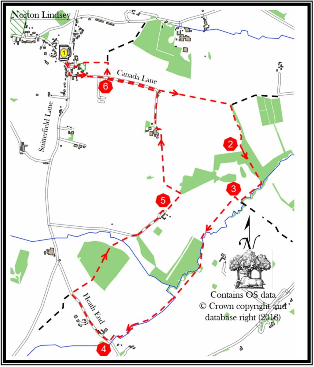
1. Leave The New Inn car park using the pedestrian path. Turn left on to Snitterfield Lane. Continue down the road and after 120m turn left into Canada Lane.
Stay on Canada Lane until it bends sharply to the right, at this point leave the road and continue straight on, down the green lane. The green lane stops at a field gate. Go through the gate and continue straight on keeping the field boundary on your left. At the far end of the field turn right within the field, again keeping the field boundary on your left.
2. In the far corner of the field you exit into a young wood via a kissing gate. The path through the wood is not too obvious, so keep parallel to the brook/ditch on your left. The wood closes in on you from your right side. At the ‘end’ of the wood there is a kissing gate into a field.
Go through the gate and skirt the field keeping the brook to your left. Continue to skirt around the edge of the field. Do not take the well-marked footpath, next to a metal gate, in the second corner. Continue to follow the field around.
3. This next section is not well signposted. Exit the field through the field entrance in the next corner into another field and continue for 30m, then turn left, through the field gate. Keep the field boundary on your left and go the length of the field. Exit through a gate into the next field. Go diagonally to the far left-hand corner. Here you will cross a brook on a footbridge.
As you enter the next field keep the wood to your right and follow the field’s boundary. This field comes to an apex in which there is a gateway and a track. This track leads into a long and narrow field. Keep the field boundary to your left and walk the field. In the corner there is a footbridge, cross it. Enter the next field and keep the field boundary to your left, walk the length of the field. Follow the boundary of the field as it corners and go to the next corner. Exit via a wooden stile and a concrete bridge. Turn immediately left and go to the corner of the field. Leave the field via a stile. After a second stile keep the field boundary to your left, as best you can, and walk the width of the field. On the far side, there is another wooden stile which leads onto a tarmac road (Heath End).
4. Turn right and go up the road for about 600m. Just after the road starts to descend take the bridle path entrance on the right. Follow the fenced path and then continue into the wood. Keeping the ditch to your right, go straight through the wood. Exit via a bridle gate into a field. Diagonally cross this field using a wooden bridge in the middle. Go through a bridle gate and emerge onto a metalled track. Turn right onto it. Its surface changes to stones after a cattle grid. Follow this driveway around the houses.
5. As the drive curves to the right, around the far end of the row of houses, take the grass track on the left into a field. Cross the field and at the far end follow the field boundary as it swings to the left and goes uphill. Exit the field via a wooden bridge and gate on your right. In the next field keep the boundary to your left and go the length of the field; up and down. In the corner is a bridle gate. Exit onto a farm track and turn left and then right, skirting around the low open shed and away from the farm house. Exit the farmyard via its driveway and continue up the metalled road. Keep on the road as it swings to the left and starts to climb.
6. After 300m, take the third field entrance on the right (this is the entrance next to the one humorously labelled “Caution Land Mines”). Keep the field boundary to you right and skirt the field’s edge around its corner and up towards the church.
Enter the churchyard through a kissing gate. Cross the churchyard keeping the church on your right. Exit through the church gate onto Church Road. Go the length of the road and turn right onto Snitterfield Road. Return to The New Inn for a well-earned drink.
If you spot any errors on this page, or would like to make suggestions to make it clearer, please let our webmaster know: webmaster@thenewinn.pub