
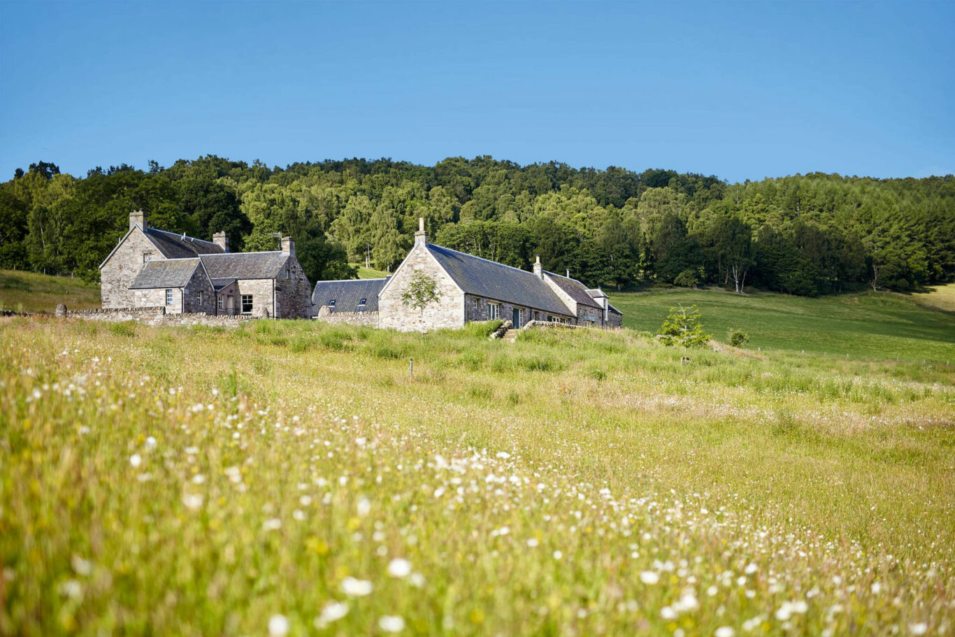
takes around 40 minutes Blacon Farm
The shortest and easiest walk. All on a solid track, road or pavement so no need for hiking gear! See the heart of our village and, weather permitting, take in some fantastic views over South Warwickshire and the Cotswolds.
Below is a map and step by step instructions, with photos, but there are also 3 other ways that you can choose to get the information:
- You can download a handy two page guide for this route, which you can print out, by clicking HERE
- This route is published on OutdoorActive, which is a free of charge app for smart phones and can be accessed HERE
- If you have a Garmin, or similar handheld SatNav, you can download the ROUTE.GPX file HERE
Overview Map
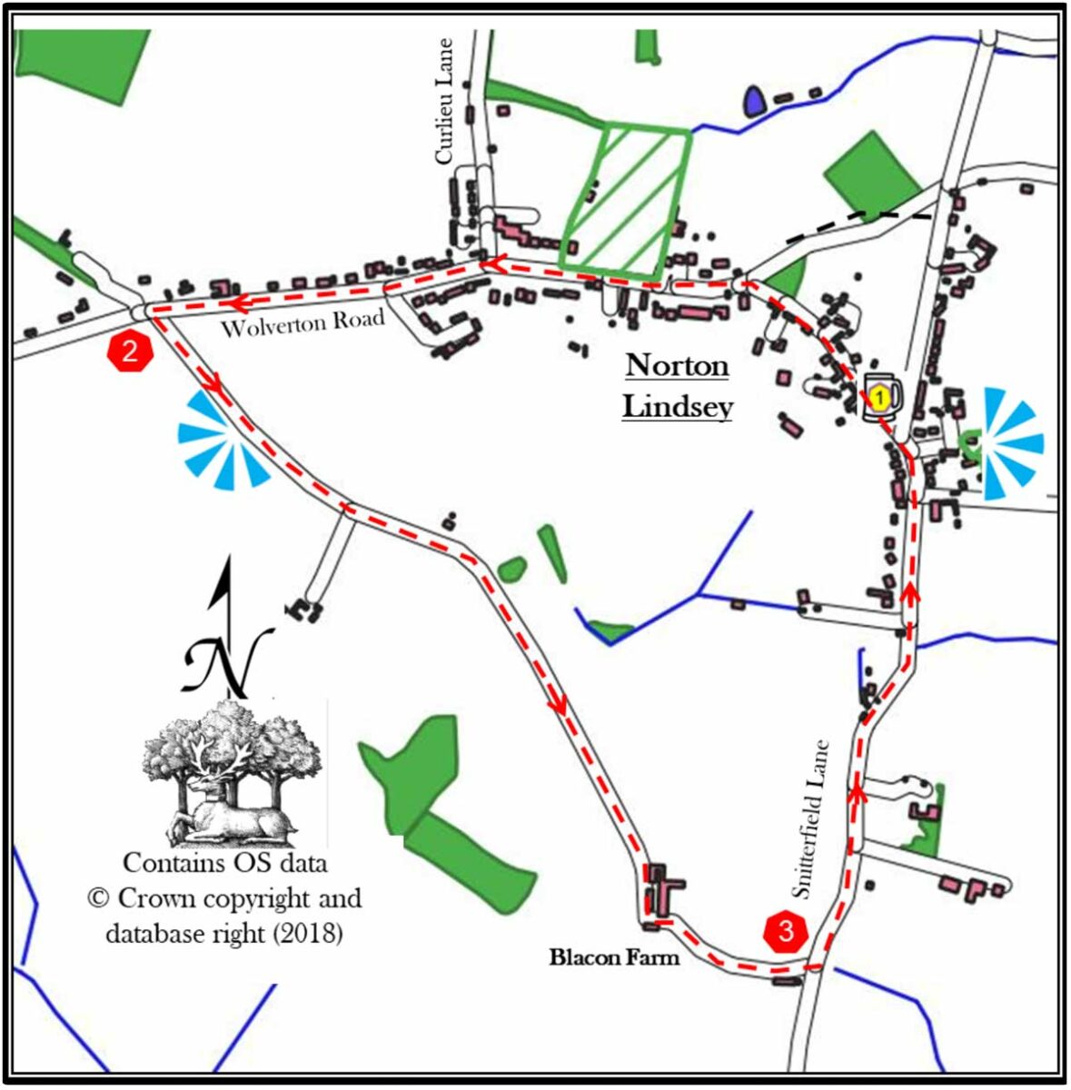
1. Leave the New Inn pub car park using the pedestrian path. Turn right onto Main Street. Proceed through the village. There are three listed buildings in the village that you will pass.; Tudor Cottages (17th century, opposite The New Inn), White House (16th century, white timber framed house on your left), and Barn Cottage (17th century, opposite White House). When you reach the Victorian Jubilee signpost (another listed building), turn left onto the main road; Wolverton Road. Cross it, when safe to do so, and continue along the footpath. Continue on this pavement for about 400 metres passing a disused windmill (another listed building) on your left, the village hall and the Elizabethan Jubilee signpost both on your right.
Cross Curlieu Lane and continue along Wolverton Road for another 500 metres. Along this section, you will pass, in order; a small thatched cottage, the village school and then another thatched cottage with peacocks on the roof
2. Just past this last house there is a track on your left. Cross the road when safe and proceed down the track. After about 100 metres stop to take in the uplifting panorama view of South Warwickshire. On most days, you will be able to see on your left Edgehill (the site of the first battle in the 17th century civil war) and to your right Ilmington, the highest point in Warwickshire and the start of the Cotswold.
Continue along this track as it descends and ascends towards Blacon Farm. Go around the farm and descend on the track. Good views of Warwick and Leamington Spa can be glimpsed on this section of the walk.
3. The track emerges onto a road (Snitterfield Lane). Turn left onto this road. There is no pavement for the next 400 metres so cross to the far side of the road and stay on the right. When the pavement appears on your left cross over when safe.
Continue along this pavement for about 450 metres. You will find that after about 100 metres the road will start a steep climb. This is the final ascent! This climb will last for about 350 metres and you should then find yourself outside of The New Inn.
As an aside, if you have the time and the inclination after the incline, there is another fantastic view from the churchyard at the rear of the church.
Retire to the New Inn for a well-earned refreshment.
If you spot any errors on this page, or would like to make suggestions to make it clearer, please let our webmaster know: webmaster@thenewinn.pub