
takes around 3 hours Four Parishes
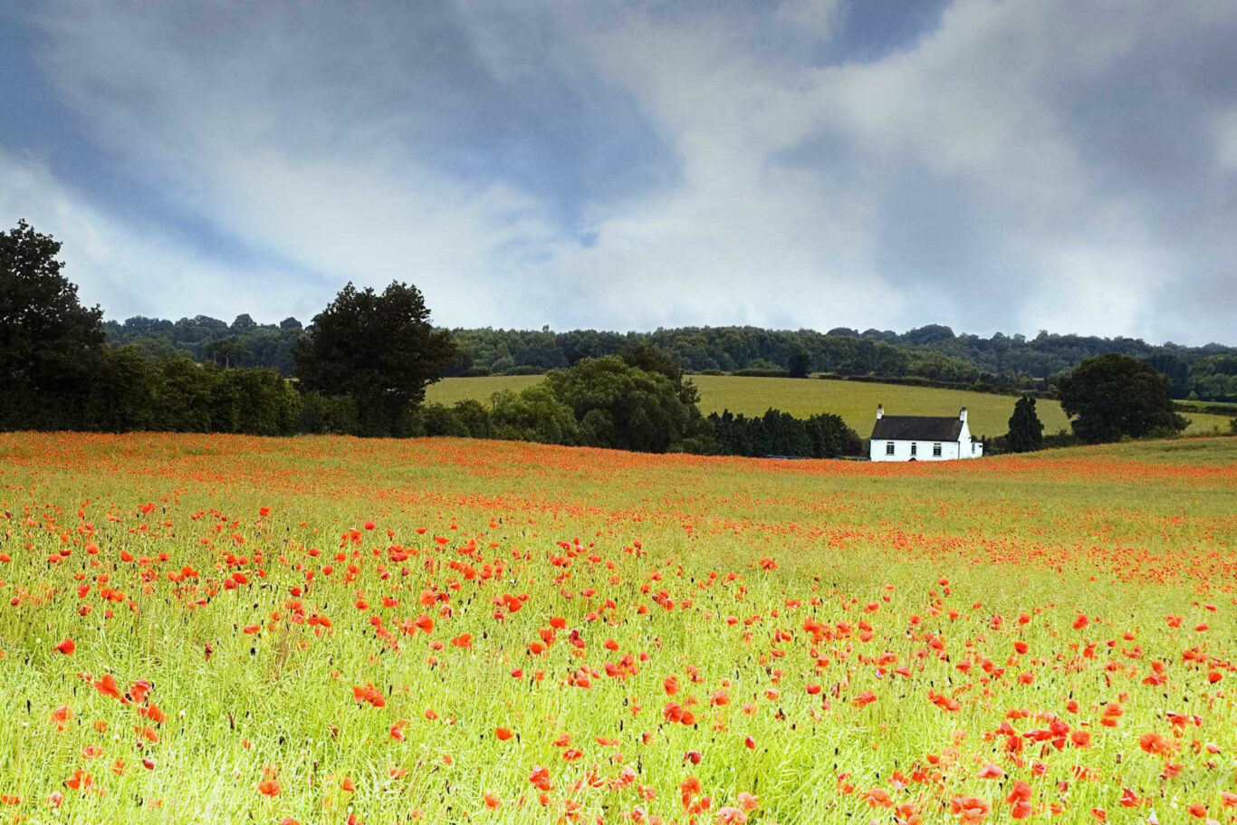
A longer walk mainly through arable fields in the beautiful undulating Warwickshire countryside. Pass through four of the local parishes, Norton Lindsey, Wolverton, Langley and Claverdon. On a clear day, see the Malvern Hills as you ascend towards Wolverton. Short-cut is available when you reach Claverdon, reducing the walk by around 1 mile.
Below is a map and step by step instructions, but there are also 3 other ways that you can choose to get the information:
- You can download a handy two page guide for this route, which you can print out, by clicking HERE
- This route is published on OutdoorActive, which is a free of charge app for smart phones and can be accessed HERE
- If you have a Garmin, or similar handheld SatNav, you can download the ROUTE.GPX file HERE
Overview Map
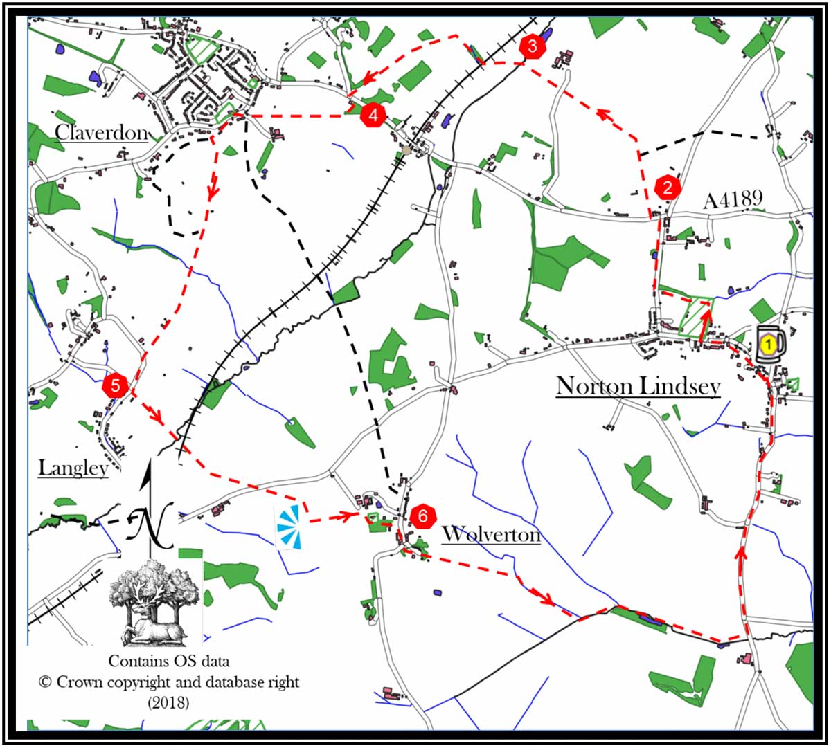
- Leave The New Inn pub car park, and turn right onto Main Street. At the T-junction turn left and cross the road to the footpath on the other side. After 200m turn right, into the sports field, through the hedge. Skirt the playing field and enter the spinney, which is in the diagonally opposite corner. Follow the track, on emerging onto a road, turn right. Continue to a T-junction.
- Cross the A4189 and dog-leg to the left, heading for Middle Gannaway’s driveway. Pass through a narrow opening immediately to the left of the gate. Continue straight on along the left side boundary of this property to a path passing through blackberry bushes at the bottom. Enter a field through a kissing gate. Keep the field boundary on your left and cross the field. Enter the next field via a kissing gate. Keep the boundary on you left and follow it as it curves to your left. Towards the end of this field the path crosses the field boundary into a neighbouring field through a gate. Turn right and follow the boundary, in the corner there is a stile into a field. Go straight over this field, and the driveway. In the field’s corner there is a metal gate, go through this and continue straight on, downwards. Keep the field boundary on your left.
- Cross the stream. The path does a dog leg, veer left. Follow the tree line through the middle of the next field, keeping the tree line to your right. The path turns right passing under the railway through gates. Enter the next two fields through metal gates and keep the field boundary to your left. Before you reach the end of the second field turn left through a field gate. Cross the next field.
- Go through an inbuilt stile. Keep the field boundaries on your right and cross the next three fields. Exit the last field, via a stile, onto a road (Star Lane). Turn left on the road towards the T-Junction. Cross the main road (A4189) and turn left.
- After a short distance turn right to the marked footpath with a stile. Follow the grass track. Where it opens into a field, bear right heading directly towards Claverdon church. Go uphill to a stile and cross the next field to a walkers’ gate and onto a tarmac track. When it meets the road turn left.
- After 200m turn left, through a metal gate, into a field. Keep the field boundary on your left and go downhill. In the corner is a kissing gate pass through and continue on the same heading. On its other side, go through a wire fence to a footbridge. Cross the stream, and cross the field keeping its boundary on your left. At its end, go through a walkers’ gate and diagonally cross the track to another walkers’ gate. Enter the field and go parallel to the track until you exit onto a road. Turn left and go for 300m. Opposite the Old Post Office, take the footpath through the walkers’ gate and continue straight on across three fields and a railway crossing. Keep the next two field boundaries on your right and then cross a third field to emerge on a road.
- Diagonally left, cross the road. Enter a field through a walkers’ gate. Go to its top left hand corner to a walkers’ gate. Enter the next field and keep the boundary to your left. There are views south west to the Malverns on a clear day. After 150m turn left through a gap in the hedge. Continue on along the ridgeline through the next field. On approaching Wolverton Church, dog leg right into the church yard and continue straight on, exiting downhill on the tarmac access road.
- At the road turn right, and continue to an open area on the left with a gravel drive. Where a grass track becomes evident, follow this keeping Wolverton Court to your right.
- In the next large field keep the boundary on your left. At the end cross a bridge and turn right keeping field boundaries on the right until reaching the far corner. The path veers right into a spinney and crosses a bridge to the next field. Continue over the next two fields with their boundaries on your right; detouring a short way left to pass through a gap in the hedge which divides them. On reaching the road, turn left and continue for 1.5km to Norton Lindsey and Retire to The New Inn for a well-earned refreshment.
If you spot any errors on this page, or would like to make suggestions to make it clearer, please let our webmaster know: webmaster@thenewinn.pub